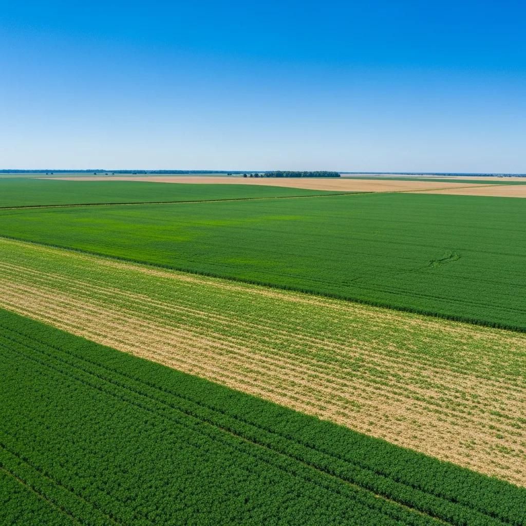
In the realm of precision agriculture, understanding the differences between NDVI (Normalized Difference Vegetation Index) and NDMI (Normalized Difference Moisture Index) is crucial for effective crop management. These indices serve as vital tools for farmers, enabling them to monitor crop health and optimize resource use. NDVI primarily measures vegetation health, while NDMI focuses on moisture levels in vegetation, making both indices essential for comprehensive farm management. Farmers often face challenges in assessing crop conditions and water stress, which can lead to inefficient resource allocation. This article will explore the definitions, mechanisms, and applications of NDVI and NDMI, as well as their significance in sustainable farming practices.
What Are NDVI and NDMI and How Do They Measure Crop Health?
NDVI and NDMI are remote sensing indices that provide insights into crop health and moisture levels. NDVI is calculated using the difference between near-infrared and red light reflected by vegetation, indicating the presence and health of plants. Conversely, NDMI utilizes near-infrared and shortwave infrared light to assess moisture content in vegetation. Both indices are crucial for farmers aiming to enhance crop yields and manage resources effectively.
Indeed, research consistently highlights the distinct yet complementary roles of these indices in agricultural monitoring.
NDVI for Vegetation, NDMI for Moisture in Farmland Management As a result, crop masks may not fully reflect ground conditions, and we therefore relied on NDVI to capture vegetation dynamics and NDMI to assess moisture patterns. Balancing Agricultural Growth and Land Degradation: The Key Role of Water Resources in Sustainable Farmland Management, 2025
How Does NDVI Indicate Vegetation Health Using Remote Sensing?
NDVI indicates vegetation health by analyzing the reflectance of light in specific wavelengths. Healthy vegetation reflects more near-infrared light and absorbs more red light, resulting in higher NDVI values. This index helps farmers identify stress patterns in crops, allowing for timely interventions. For instance, satellite imagery can reveal areas of a field that may require additional nutrients or water, ultimately improving crop management strategies.
In What Ways Does NDMI Detect Crop Water Stress and Moisture Levels?
NDMI detects crop water stress by measuring the moisture content in vegetation. It is particularly useful for irrigation management, as it provides data on vegetation moisture levels rather than directly measuring soil moisture. By monitoring NDMI values, farmers can make informed decisions about irrigation schedules, ensuring that crops receive adequate water without over-irrigating. This capability not only conserves water resources but also enhances crop resilience during dry periods.
Why Is Comparing NDVI and NDMI Important for Precision Agriculture?
Comparing NDVI and NDMI is essential for precision agriculture as both indices offer complementary insights into crop health and moisture status. Understanding their differences allows farmers to implement more effective management practices, optimizing resource use and improving overall farm productivity.
What Are the Key Differences Between NDVI and NDMI in Crop Monitoring?
The key differences between NDVI and NDMI lie in their measurement focus. NDVI primarily assesses vegetation health, while NDMI focuses on moisture content within vegetation. This distinction is crucial for farmers who need to monitor both aspects to ensure optimal crop growth. For example, NDVI can indicate when plants are under stress due to nutrient deficiencies or disease, whereas NDMI can signal when crops are experiencing water stress.
How Can Combining NDVI and NDMI Improve Farm Resource Optimization?
Combining NDVI and NDMI can significantly enhance farm resource optimization. By utilizing both indices, farmers can gain a comprehensive understanding of their crops' health and moisture needs. This synergistic approach allows for better decision-making regarding irrigation, fertilization, and pest management. For instance, a farmer might use NDVI to identify areas needing nutrients while simultaneously using NDMI to ensure those areas receive adequate water.
The integration of these indices is increasingly recognized as fundamental for advanced agricultural practices and predicting future yields.
NDVI & NDMI for Precision Agriculture & Yield Forecasting a classification framework explicitly optimized for this unique informed vegetation indices NDVI, NDRE, NDMI, EVI, GNDVI, yield forecasting and precision agriculture Optimizing Agricultural Land Use Mapping: Integrating Multiple Algorithms for Wheat Classification in Sindh's Naushehro Feroze District, Pakistan, S Ashfaq, 2025
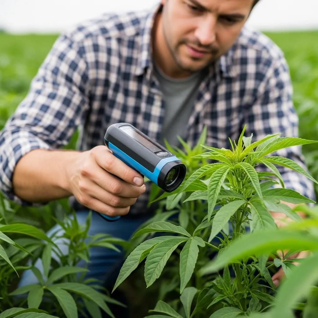
Which Remote Sensing Technologies Support NDVI and NDMI Analysis on Farms?
Various remote sensing technologies support NDVI and NDMI analysis, enabling farmers to gather accurate data for effective decision-making. Satellite imagery and drone data are among the most prominent technologies used in this context.
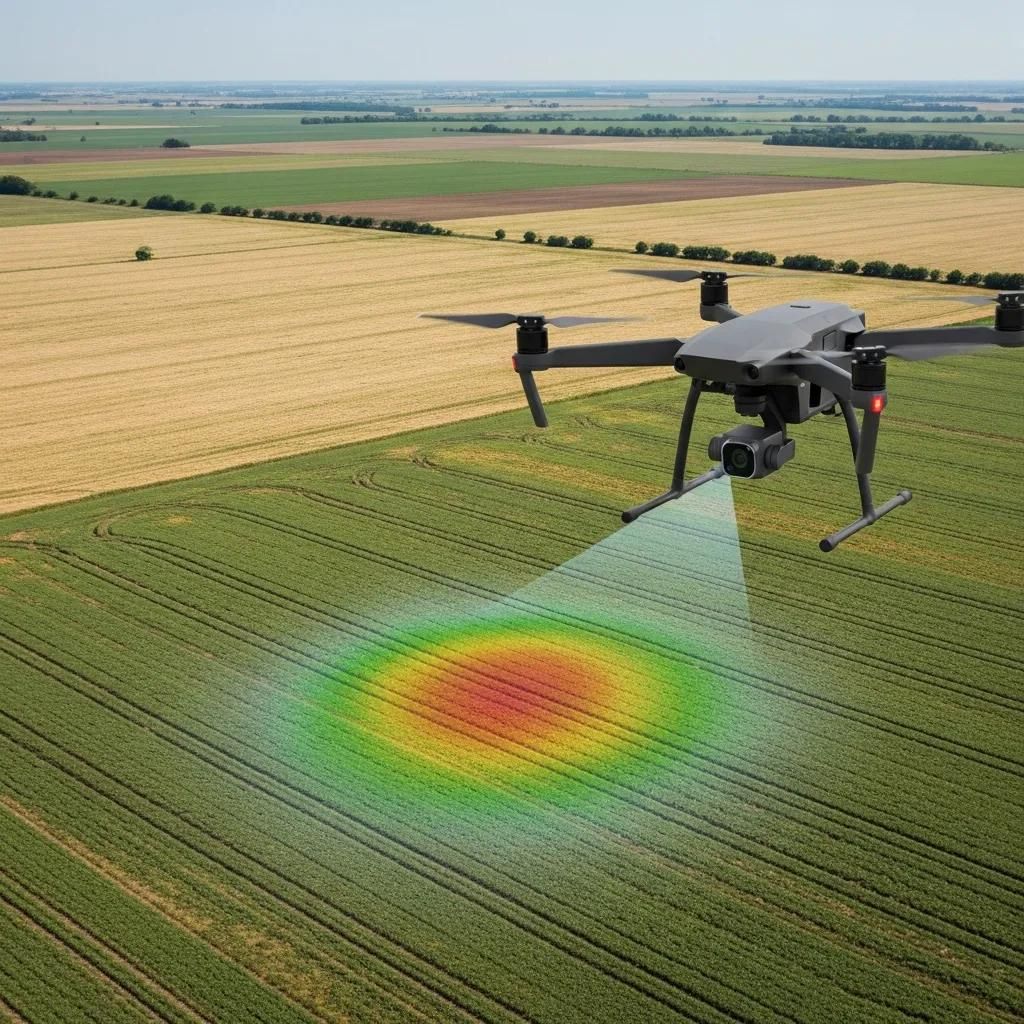
How Do Satellite Imagery and Drone Data Enable Accurate Vegetation Indices?
Satellite imagery provides a broad view of agricultural fields, allowing for the monitoring of large areas over time. Drones, on the other hand, offer high-resolution images that can capture detailed information about specific sections of a farm. Both technologies facilitate the collection of NDVI and NDMI data, enabling farmers to make informed decisions based on current field conditions.
What Precision Agriculture Tools Does Farm United Offer for NDVI and NDMI Monitoring?
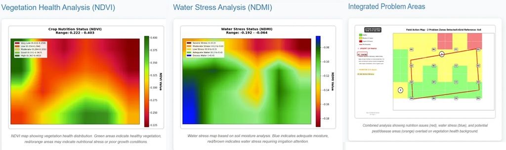
Farm United offers a range of precision agriculture tools designed to support NDVI and NDMI monitoring. These tools include advanced software for data analysis and visualization, helping farmers interpret the indices effectively. By leveraging these technologies, farmers can enhance their crop management practices and optimize resource use, aligning with sustainable farming principles.
How Do NDVI and NDMI Contribute to Sustainable Farming Practices?
NDVI and NDMI play a significant role in promoting sustainable farming practices by enabling farmers to monitor crop health and moisture levels accurately. This capability supports resource optimization and reduces waste, contributing to more environmentally friendly agricultural practices.
In What Ways Do Vegetation and Moisture Indices Support Climate-Resilient Agriculture?
Vegetation and moisture indices like NDVI and NDMI support climate-resilient agriculture by providing critical data that helps farmers adapt to changing environmental conditions. For instance, by monitoring moisture levels, farmers can adjust irrigation practices to conserve water during droughts, ensuring crop survival and productivity.
Further studies underscore how these indices are instrumental in developing comprehensive assessments for agricultural resilience against environmental shifts.
NDMI for Moisture, NDVI for Vegetation in Agricultural Sensitivity A Flood Risk Index was developed to assess flood risk utilizing Normalised Difference Water Index (NDWI), Normalised Difference Moisture Index (NDMI), Rainfall, Slope, Elevation, Nearness of River, and Population Density, which was integrated with agricultural land cover. Normalised Difference Vegetation Index (NDVI) trends and variability over the 20-year period were used to develop an Agricultural Sensibility Index—which was the vegetation response. Policy zoning for climate-resilient agriculture: a spatial assessment of agricultural sensitivity and resilience to environmental change in West Bengal, India, S Saha, 2025
What Are Practical Benefits of Using NDVI and NDMI for Crop Water Stress Detection?
Using NDVI and NDMI for crop water stress detection offers several practical benefits. These indices enable farmers to identify stress patterns early, allowing for timely interventions that can enhance crop yields. Additionally, optimizing irrigation based on NDMI data can lead to significant water savings, making farming more sustainable in the long run.
See Farm United in Action
Discover how our AI-powered platform helps farmers digitize, monitor, and grow smarter.
Book a Free Demo →